Created by - Josephine Hill
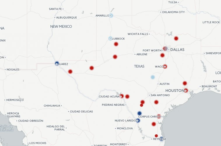
Making the map shown here—which represents the locations, operation dates, and management statuses of Texas’s 33 facilities used to detain migrants—involved reckoning with sources that often contradicted one another or refused specificity. Some of the research tactics our class used to compile this information included collecting Immigration and Custom Enforcement (ICE) contract documents, cold-calling detention centers, combing through local newspaper archives and ICE maintenance audits, and zooming in as close as possible on Google street view. We quickly learned that the landscape of detention is elusive and ever evolving. Some publicly (ICE) run facilities become private when a prison corporation is awarded a new contract; some centers are taken over by the County when a private corporation abandons its contract. Nonetheless, the map captures the extent to which an infrastructure of detention throughout Texas has expanded, multiplied, and privatized over the course of the past 30 years.